Улога детектора дубоких вода у морској археологији
Напредности у геофизичкој истраживачкој технологији
Сензори за дубину воде су заиста променили начин на који данас радимо морску археологију. Они дају истраживачима потпуно нову перспективу о томе шта лежи испод таласа захваљујући детаљним мапама које стварају под морем. Технологија иза овог напретка укључује неке прилично импресивне геофизичке алате као што су мулти-бејм сонар системи и сонарска опрема за страни скенирање. Са мулти-спромним сонаром, археолози добијају потпуне тродимензионалне слике површине морског дна. Сонар са бочним скенирањем ради другачије, али је једнако ефикасан у скенирању великих делова дна океана и уочава чудне облике или објекте који би могли бити остаци древних цивилизација. Ове модерне технике помажу стручњацима да много боље од раније примете и проучавају подводне структуре, што значи да експедиције на терену могу усредсредити своје напоре тамо где је најважније, без губљења времена на случајне претраге.
Можемо да видимо како технологија мења ствари када погледамо све нове археолошке локације недавно пронађене. Морски истраживачи су о томе говорили годинама. Они тврде да опрема као што су мулти-беч и сајд-скен сонари чине проналажење подводних локација много лакшим него пре. Ови алати нам омогућавају да уочимо места која су била или превише дубока или су једноставно пропуштена све до недавно. Узмимо као пример Универзитет у Саутхемптону. Њихов тим је заправо документовао доста нових налаза након што су почели да користе ове напредне методе скенирања. Занимљиво је не само колико локација су пронашли, већ и у ком су стању те локације. Таква врста информација заиста помаже историчарима да саставе приче о древним цивилизацијама. Како се ови алати наставе унапређивати, вероватно ћемо и даље откривати више скривених делова историје испод таласа.
Примене ЛСИ-а: од камера за канализацију до мапирања океана
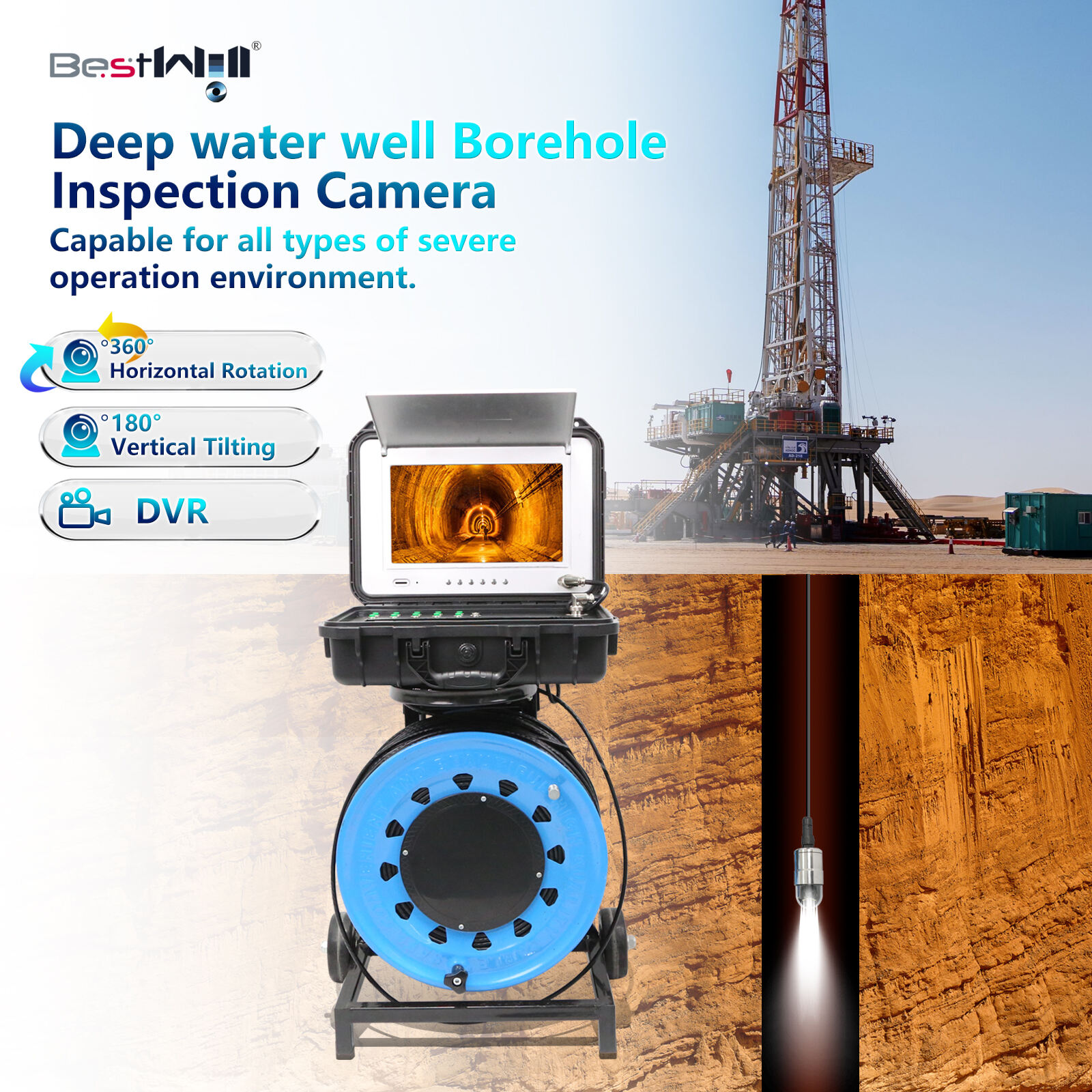
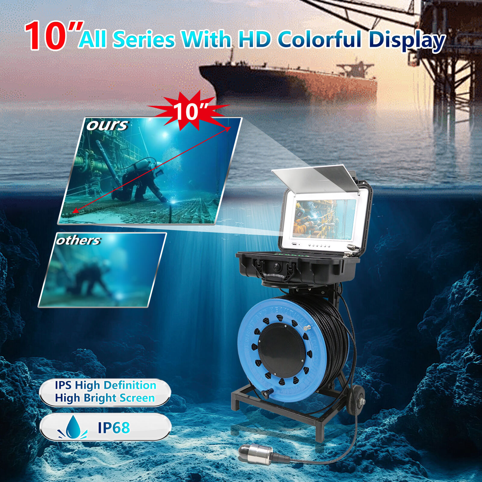
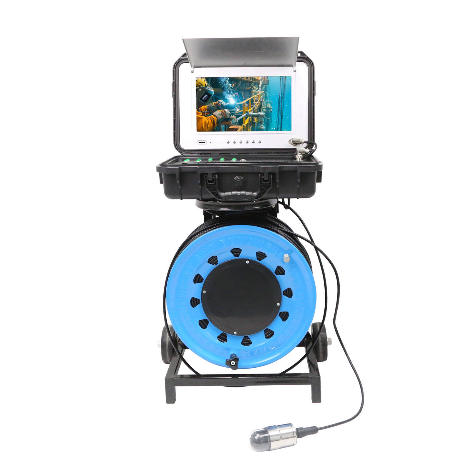
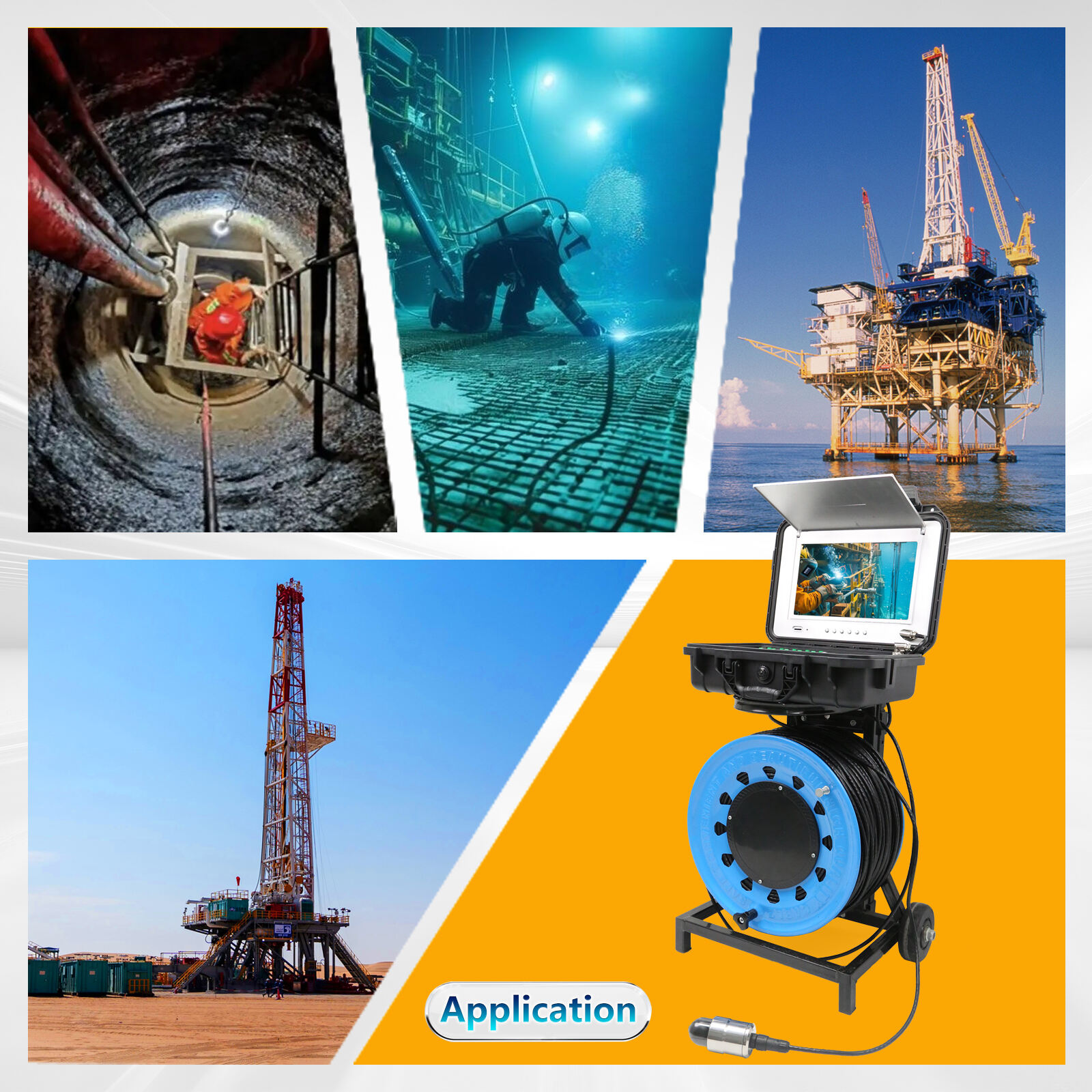
Технологија за инспекцију канализација, која је првобитно била намењена за проверу цеви и канала, сада се појављује на неочекиваним местима као што је океан. Исти камери које се протежу кроз подземне тунеле изненадно добро функционишу и у уским приобалним водама. Морски истраживачи су почели да користе ове компактне системе за снимање како би прегледали бродоломе и друга потопљена места на која се традиционална опрема не може пробити. За археологе, то значи детаљан преглед древних бродова који леже на морском дну, без потребе да се ангажују скупе подводнице. Неке екипе су чак откриле нова места бродолома јер су најзад могле да виде оно што је било скривено испод слојева талога које би већа опрема узбуркала.
Најновија технологија инспекције постала је изузетно добра у креирању детаљних мапа морског дна, чиме се олакшава проналажење разноврсних старина и подводних грађевина. Морски археолози сада користе унапређене верзије оних канализационих камера које видимо у ТВ серијама, како би испитали велике подводне просторе и направили фотографије које показују ствари које људи до сад нису знали да постоје. Замислите ово на следећи начин: баш као што водоводници гледају унутра у цеви у потрази за запушенима, ове унапређене камере омогућавају истраживачима да погледају у сваки захваћени део морског дна где се налазе древни артефакти и заборављене структуре, јер су или превише дубоко или су једноставно тешке за приступ. Занимљиво је колико су заправо свестране ове модификоване канализационе камере. Оне више нису само алати, већ заиста револуционарни фактор у разумевању онога што се десило испод наших океана кроз историју.
Нeуронске мрeжe и хиперспектрална визуeлизација зa откривањe артефаката
Спектрална анализа потопљених археолошких локација
Спектрално сликање има важну улогу у откривању хемијског састава предмета скривених под водом, што археолозима омогућава истраживање подводне историје без додира. Када научници проучавају како различити објекти одбијају светлост на различитим таласним дужинама, добијају назнаке о њиховој изради и могућном пореклу. Недавни рад објављен у часопису Marine Archaeology показује колико је ова метода ефективна. Истраживачи су користили хиперспектралне податке да повежу одређене светлосне обрасце са познатим материјалима, што им је помогло да пронађу неколико досад непознатих подводних локација. Вредност ове технологије огледа се у њеној способности да разликује природне седименте морског дна од стварних артефаката скривених испод. Многи стручњаци сада сматрају да је хиперспектрално снимање готово незаобилазно за заштиту нашег потопљеног културног наслеђа. Оно пружа теренским истраживачима разноврсне детаљне информације које су неопходне ако желимо да очувамо ова важна места за будуће генерације.
Модели дубоког учења за класификацију циљева
Вештачке неуронске мреже постају заиста корисне за сортирање артефаката тако што анализирају како изгледају и које светлости рефлектују, чиме се мења начин на који археолози обављају свој посао. Системи дубоког учења обрађују сложене информације како би одредили која је врста артефакта у питању, његово стање очуваности, а некад чак и њихов датум настанка. Студија из часописа Вештачка интелигенција у археологији показује да ови алгоритми значајно побољшају класификацију, тако да предвиђања постану бржа и прецизнија. Неке тестове су заправо показале да неуронске мреже тачно препознају преко 90 посто артефаката у симулираним подводним условима. Када се комбинује визуелни преглед са спектралном анализом, ови компјутерски модели омогућавају истраживачима да истражују потопљена места без иједног нуркања, чиме се смањује изложеност људских операција у тешким подводним условима. Марина археологија је недвосмислено напредовала захваљујући неуронским мрежама, које стручњацима нуде много боље начине за откривање и категоризацију подводних античких предмета него што је икада раније било могуће.
Regulatorni okviri za podvodna istraživanja
Zahtevi BOEM-a za arheološko izveštavanje
Биро за управљање енергетским ресурсима океана, познат и као BOEM, усвојио је одређена правила о начину на који се припремају археолошка испитивања када се врши истраживање испод морске површине. Ова правила су веома важна јер помажу да се осигура да особе које истражују подводни простор не униште важне делове наше морске историје. Када се прате BOEM-ова правила у извештавању, неопходно је пажљиво размотрити како би радови могли да утичу на подводне културне локације. Углавном, то подразумева доставу неке врсте извештаја о могућим штетама које би могле да настану, пре него што започну било какви радови. Такво планирање помаже у заштити старих бродолома и других подводних артефаката од могуће штете. Пратећи ова правила, не само да се поступа исправно, већ се заштићу вредни делови морске историје, како би их дуже време после нас могли истраживати рониоци и историчари.
Prilagođavanje standardima Zakona o nacionalnom nasleđu (NHPA član 106)
Član 106 Zakona o nacionalnom očuvanju istorijske baštine izuzetno je važan kada je u pitanju otkrivanje i zaštita arheoloških nalaza tokom radova ispod vode. On zahteva da osobe koje sprovode takve projekte prođu kroz detaljan postupak ocenjivanja pre nego što započnu bilo kakve aktivnosti koje bi mogle da naškode kulturno značajnim lokalitetima pod vodom. Uzmimo, na primer, poznati slučaj kada su pronađeni delovi broda USS Monitor pored obale Severne Karoline – to je bilo omogućeno upravo usled zahteva iz Člana 106. Kada timovi koji rade na podvodnim projektima pažljivo prate ova pravila i ozbiljno pristupe planovima očuvanja, na kraju pomognu da se zaštiti naše zajedničko istorijsko nasleđe, a da istovremeno istraživanja mogu da se sprovode. Smernice koje je NHPA usvojila stvaraju okvir u kome možemo istraživati bez oštećivanja onoga što čini ove lokacije istorijski vrednim.
Методологије инспекције цевовода у подводним условима
Прилагођавање YOLOv4 за праћење подводне инфраструктуре
YOLOv4 је пронашао нове примене у надзору подводних цевовода у реалном времену, чиме су инспекције омогућене чак и у условима у којима традиционалне методе имају проблема. Она што је започела као система за детекцију објеката развила се у нешто што је прилично корисно за проналажење делова цевовода под водом са прилично добром тачношћу. Подводне инспекције су и без тога тежак посао, с обзиром на разне проблеме који настају од рефракције светлости до мутих вода, али YOLOv4 изненађујуће добро носи са тим проблемима. Рад под називом Deep Learning Approach for Objects Detection in Underwater Pipeline Images пријавио је да је овај модел постигао око 94,21% просечне тачности, што је боље од већине конкуренције у погледу брзине детекције. За компаније које одржавају подводну инфраструктуру, то значи да могу прецизније планити радове на одржавању и учинити операције безбеднијим у целини, без тога да се ослањају на скапе рониоце или подводнице за сваку проверу.
Otkrivanje curenja pomoću akustičnog mašinskog učenja
Mašinsko učenje primenjeno na akustične signale menja način na koji otkrivamo curenja u podvodnim cevovodima, omogućavajući znatno bolju osetljivost u odnosu na tradicionalne metode. Podvodni zvučni talasi ostaju najbolja opcija za nadgledanje jer ne ometaju morski život, a istovremeno prenose korisne informacije. Ove signale analiziraju kompleksni kompjuterski programi koji prepoznaju nepravilnosti koje mogu ukazivati na postojanje curenja negde u sistemu. Nedavna studija objavljena u Časopisu za pomorsku tehnologiju pokazala je obećavajuće rezultate kada su istraživači obučavali svoje modele na stvarnim akustičnim podacima iz sistema cevovoda. Iako ove tehnike nesumnjivo pomažu u bržem otkrivanju problema, one takođe smanjuju i ekološku štetu i skupu prostoje za operatere. Napredak u ovoj oblasti omogućava kontinuirano praćenje stanja cevovoda, iako implementacija ovakvih sistema na svu offshore infrastrukturu ostaje izazov za mnoge kompanije koje se brinu o zaštiti morskih ekosistema.
Nove tehnologije u zaštiti morskih resursa
Интеграција IoT сензора са инспекционим камерама
Комбиновање IoT технологије са камерама за инспекцију под водом мења начин на који управљамо морским ресурсима. Ови IoT сензори у суштини побољшавају могућности које имају камере за инспекцију канализације, омогућавајући праћење у реалном времену и одмах испоручујући податке, тако да оператори могу брзо да реагују када је то неопходно. Шта ово значи за управљање морским ресурсима? Па, омогућава нам да много боље пратимо отоке и разне подводне објекте у поређењу са претходним могућностима. Када се ове две технологије комбинују, оператори могу да прате морске екосистеме на даљину, да идентификују проблеме много раније него што је то било могуће и да пруже решења пре него што ситуација угрози морску фауну. Применом овог приступа, омогућава се одржавање еколошки прихватљивих пракси управљања, као и добијање детаљније информације о стању у нашим водним системима.
Предиктивна анализа за очување локација
Предиктивна анализа постала је прилично корисна за откривање проблема пре него што погоде подводне археолошке локације, тако да тимови за очување могу да делују унапред, уместо да реагују након што је дошло до оштећења. Када се упореде сви подаци прикупљени из различитих извора, ови аналитички алати помажу у откривању ствари попут постепеног узгона тла или неочекиване људске активности у близини осетљивих области које могу да угрозе историјске локације под водом. Заправо, постоји прилично много истраживања која показују колико је овај приступ био ефективан у различитим морским срединама. Узмимо као пример Велики баријерни гребен, где су предиктивни модели на време истакли забринавајуће промене, много пре него што су видљиви знаци тога постали уочљјиви на површини, чиме су стручњацима дати драгоцени додатни месеци за спровођење заштитних мера. Иако ниједан систем није савршен, овакав технолошки напредак дефинитивно помаже у бољој заштити нашег подводног наслеђа него што су традиционалне методе могле да постигну, и потиска нас ка одговорнијим приступима у управљању океансима културним добром у годинама које долазе.
Садржај
-
Улога детектора дубоких вода у морској археологији
- Напредности у геофизичкој истраживачкој технологији
- Примене ЛСИ-а: од камера за канализацију до мапирања океана
- Нeуронске мрeжe и хиперспектрална визуeлизација зa откривањe артефаката
- Спектрална анализа потопљених археолошких локација
- Модели дубоког учења за класификацију циљева
- Regulatorni okviri za podvodna istraživanja
- Zahtevi BOEM-a za arheološko izveštavanje
- Prilagođavanje standardima Zakona o nacionalnom nasleđu (NHPA član 106)
- Методологије инспекције цевовода у подводним условима
- Прилагођавање YOLOv4 за праћење подводне инфраструктуре
- Otkrivanje curenja pomoću akustičnog mašinskog učenja
- Nove tehnologije u zaštiti morskih resursa
- Интеграција IoT сензора са инспекционим камерама
- Предиктивна анализа за очување локација