HD Visual Imaging Reduces Interpretation Ambiguity in Geological Logging
The accuracy gap: Why traditional geophysical logs often misrepresent fractures and lithology
The old school geophysical logging techniques basically guess what's going on underground by looking at things like resistivity readings, gamma rays, or how sound waves bounce back from rock layers. But this indirect approach leaves out a lot of important details about what's actually happening beneath the surface. When it comes to figuring out where fractures run, spotting those thin layers of clay, or identifying mineral deposits, these methods often miss the mark because the sensors just aren't fine enough. Especially when dealing with complex rock formations full of cracks and mixed materials, the limitations become even more apparent. Since there's no actual picture to look at, geologists have to make educated guesses based on their experience, which naturally introduces some level of uncertainty into everything from building geological models to deciding where to drill next and estimating how much oil or gas might be present.
How borehole inspection camera systems resolve ambiguity with side-facing optics, adaptive LED lighting, and real-time HD video
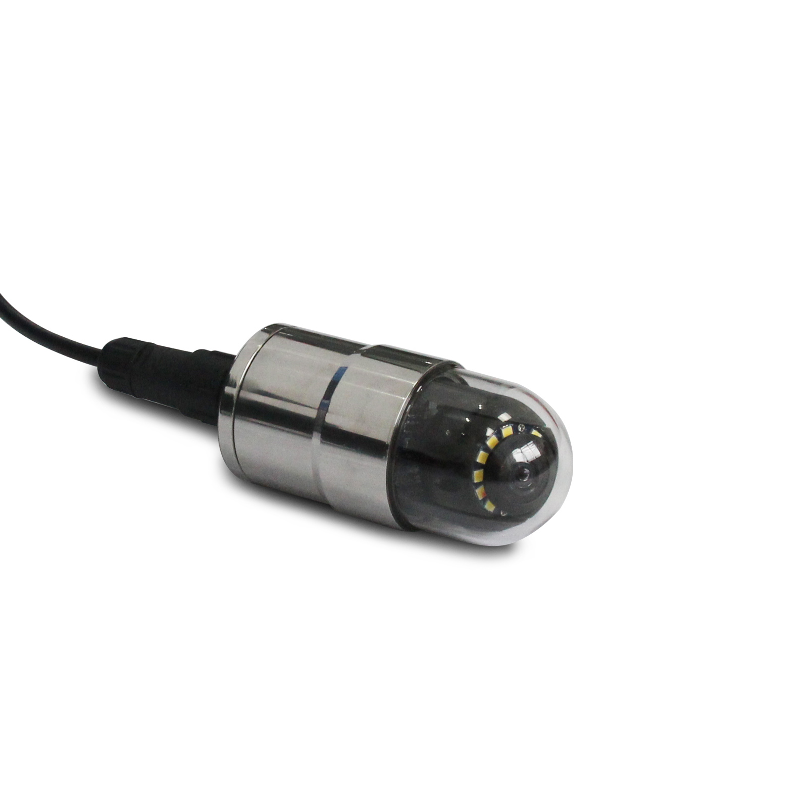
Borehole inspection cameras today cut through all that uncertainty by giving us clear visuals right from the source. The side facing lenses map out fractures completely around the well, even when things get crooked down there. And those smart LED lights adjust automatically depending on how clear or murky the fluids are in the hole. What we see in real time HD video? Details as small as a few millimeters show up crystal clear joint fillings, tiny cracks, signs of weathering, and those hard to spot changes between different rock layers that regular logging just misses. Field crews can now check where core samples didn't come back properly, tell if fractures actually contain minerals versus being empty spaces, and stop relying so much on computer models. Instead of guessing what those strange readings mean, they get actual proof right there in front of them turning confusing signals into real decisions for geologists to act on.
Objective Structural Analysis: Quantifying Rock Features for Better Sampling and Modeling
From subjective lithological descriptions to measurable visual data: Stereopair imaging and orientation mapping
Qualitative descriptors like "highly fractured" or "moderately weathered" introduce interpretive bias that undermines exploration reliability. Borehole inspection cameras address this with stereopair imaging—capturing dual-angle, synchronized images to reconstruct accurate 3D structural models. This enables precise quantification of:
- Fracture density (fractures per meter)
- Joint orientation (dip and strike relative to true north)
- Weathering depth (measured at sub-millimeter resolution)
- Vein thickness and continuity distributions
Modern orientation mapping tools now include spatial metadata like inclination angles, azimuth directions, and depth measurements right within images themselves. When field data gets converted into actual numbers that can be measured and repeated, it really helps improve how we plan our samples, model stresses in rock formations, and simulate how fluids might move through underground structures. According to several studies published in geotech journals, moving away from just describing what we see to actually engineering our logging methods cuts down drilling risks around 22 percent. This makes a big difference when building accurate resource maps and figuring out where to dig next without wasting time or money.
Motorized Borehole Inspection Cameras Enable Targeted Feature Identification in Complex Formations
Advantages of pan/tilt/focus control over static push cameras in deviated or fractured boreholes
The problem with static push cameras becomes apparent when dealing with deviated or complicated boreholes. Their fixed front-facing lenses simply can't capture much of what's going on around them, often picking up less than 40% of the actual borehole wall in situations where the hole has deviated beyond 15 degrees. This means important features like cracks along the sides, changes between different rock types, and signs of instability get missed entirely. Motorized camera systems solve these issues through pan and tilt movements, adjustable focus settings, and instant position updates from sensors. With these features, operators can scan the entire 360 degree circumference of the borehole, spot tiny details such as calcite deposits or clay layers, and specifically document areas prone to collapse or water flow channels. This proves especially useful when working with folded rock formations or limestone structures that have been altered by water over time. Real world testing indicates that switching to motorized cameras cuts down on the need for repeat logging by about two thirds in challenging mineral exploration work, speeding up the whole data collection process while still maintaining high quality results.
Integrating Borehole Inspection Camera Data into Exploration Workflows Optimizes Resource Allocation
When companies start feeding HD footage from downhole inspection cameras straight into their exploration processes, it completely changes how decisions get made across the board. From picking targets right through to figuring out where and how much to sample, having actual visuals beats relying on guesswork based on old school geophysics readings. Field crews tell us all the time that this approach makes their drilling spots way more accurate and helps them decide exactly how many samples they need to collect. The numbers back this up too – most projects see around a 25% drop in costs because there's less need for fixing mistakes later on, better use of expensive gear, and staff just plain work smarter. What's really nice is that these savings don't come at the expense of good science or clean data. Instead, everything gets done faster, stays within budget, and leaves a smaller mark on the environment while still maintaining solid geological standards.
FAQ
What are the limitations of traditional geophysical logging techniques?
Traditional geophysical logging often relies on indirect methods like resistivity readings and gamma rays, which may not capture detailed underground features leading to potential inaccuracies.
How do borehole inspection cameras improve geological exploration?
Borehole inspection cameras provide real-time HD visuals of geological features, enabling accurate mapping and reducing reliance on indirect interpretations, thus lowering exploration risks.
What advantages do motorized borehole inspection cameras offer?
Motorized borehole cameras offer pan, tilt, and focus controls, allowing a comprehensive view of borehole walls, which is crucial for identifying minute geological features in complex formations.
How does integrating borehole camera data impact exploration costs?
Integrating borehole camera data significantly reduces exploration costs by decreasing the incidence of methodological errors, optimizing resource allocation, and improving decision-making accuracy.
Table of Contents
- HD Visual Imaging Reduces Interpretation Ambiguity in Geological Logging
- Objective Structural Analysis: Quantifying Rock Features for Better Sampling and Modeling
- Motorized Borehole Inspection Cameras Enable Targeted Feature Identification in Complex Formations
- Integrating Borehole Inspection Camera Data into Exploration Workflows Optimizes Resource Allocation
- FAQ