
Fiske är mer än bara en hobby för många – det är en passion som går utöver vattentyper, från de lugna sjöarna och slingrande floderna i sötvatten till de dynamiska haven och kustbuktarna i saltvatten. Nyckeln till en framgångsrik fisketur, oavsett om du är en tillfällig fiskare eller en professionell fiskare, ligger i att ha rätt verktyg för att avslöja hemligheterna i undervattnets värld. En högkvalitativ fisklokator är inte längre en lyx utan en nödvändighet, och Shenzhen Beyond Electronics Co., Ltd har omdefinierat vad som är möjligt med sitt sortiment av fiskesökare och under vattneskamera för fiske produkter som är konstruerade för att leverera obestridlig prestanda i både sötvatten och saltvatten. Med mer än 20 års erfarenhet av tillverkning, ISO9001-certifiering och en kundcentrerad designfilosofi har företaget utvecklat lösningar för fisklokalisering som anpassar sig till de unika utmaningarna i varje vattenmassa, vilket omvandlar gissningar till exakt, datastyrd fiske.
Färskvattensfiske kräver en fisklokator som är särskilt effektiv i grunt till medeldjupt vatten, där vattnets genomskinlighet kan variera och fiskar ofta gömmer sig i strukturer som stenar, vass och fallna träd. Fisklokatorer från Shenzhen Beyond Electronics, såsom CR110-7HBS-isfiskelokatorn och CR110-4HAS-fisklokatorns kamera, är utformade för att hantera just dessa förhållanden. Utrustade med avancerad sonarteknik upptäcker dessa enheter fiskens position, djup och skolförstoring med hög noggrannhet, även i grumligt färskvatten, och levererar realtidsdata till användarens display. Den 4,3 tum stora IPS-skärmen på CR110-7HBS och den kompakta designen på CR110-4HAS säkerställer portabilitet – avgörande för fiskare som flyttar mellan olika fiskeplatser – samt intuitiv drift, så att du spenderar mindre tid på att justera inställningar och mer tid på att kasta ut spöet. Vad som särskiljer dessa färskvattensfisklokatorer är deras kompatibilitet med undervattensfiskkameror ; genom att kombinera sonardata med live-undervattnesvideo kan du inte bara hitta fisk utan också iaktta dess beteende – från hur den reagerar på betet till var den befinner sig i vattenkolumnen. Denna kombination är en spelomvälvare för sötvattensfiskare som siktar på abborre, öring, gös eller skärsnäcka, eftersom den eliminerar gissningarna kring identifiering av fiskarter och deras födovanor.
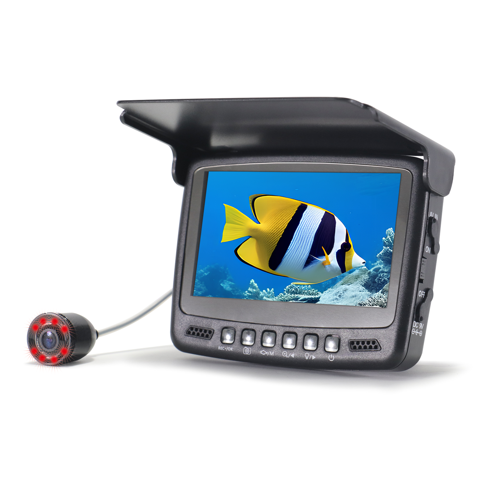
Salthavsfiske ställer helt andra krav: djupare vatten, starkare strömmar, saltkorrosion och ett bredare utbud av fiskarter – från kustnära rödfisk och snapper till havsutsatta marlin och tonfisk. Shenzhen Beyond Electronics möter dessa utmaningar med fiskelocatorer och undervattensfiskkameror utvecklade för tufft salthavsanvändning. Alla produkter med salthavsgodkännande har en robust, korrosionsbeständig konstruktion som tål saltstänk och nedsänkning, medan deras högeffektiva sonarsystem når djup som sötvattensmodeller inte klarar av – de upptäcker fiskskolar flera sjömil ut till havs och i djupa kustkanaler. Företagets fiskkamera rad, inklusive isfiskkameran CR110-7HES (anpassningsbar för öppet saltvatten), har vattentätighet upp till 50 m, 24 justerbara lampor och balansvikter i rostfritt stål – funktioner som säkerställer tydlig och stabil video även i vågigt saltvatten och vid låg belysning. Till skillnad från grundläggande fisklokatorer som endast visar sonarblipp, låter dessa kameraintegrerade system dig se fiskarna i realtid, skilja mellan målarter och spetsfisk, samt kontrollera konditionen på din locka eller bete. För saltvattenfiskare är denna synlighetsnivå ovärderlig, särskilt när man siktar på lätt skrämda offshore-arter som kräver exakt presentation.
Vad som verkligen gör Shenzhen Beyond Electronics fisklokatorer till bästa valet för både sötvatten- och saltvattenfiske är deras mångsidighet. Många modeller, till exempel CR110-5HBS med 5 tum IPS-skärm för isfiskekamera, är utformade för att fungera sömlöst i båda vattentyperna, med justerbara inställningar som låter dig växla mellan sötvatten- och saltvattenlägen på sekunder. Detta eliminerar behovet av separat utrustning för olika fisketur, vilket sparar fiskare pengar och plats i deras fiskredskapslåda. Dessutom är företagets undervattensfiskkameror kompatibla med övervakningsenheter från andra varumärken, vilket ger dig flexibiliteten att integrera dem i din befintliga fiskutrustning. Oavsett om du fiskar isfisk på en sötvattensjö på vintern eller djuphavsfiskar i havet med saltvatten på sommaren anpassar sig dessa enheter till din miljö och levererar konsekvent, pålitlig prestanda varje gång.
Hållbarhet är en annan grundpelare i Shenzhen Beyond Electronics design. Saltvatten är notoriskt skadligt för fiskredskap och orsakar rost och korrosion som kan göra även den bästa utrustningen obrukbar på kort tid. Företagets fiskelokatorer och undervattenskameror är tillverkade av högkvalitativa material, inklusive aluminiumhöljen och förstärkta kablar, för att motstå skador från salt. Den handhållna kabelrullen med aluminiumhölje för inspektionskameran CR110-10D1 för avlopp är ett tydligt bevis på denna hållbarhet, och samma konstruktionsprinciper tillämpas på alla fiskprodukter. Dessutom har alla enheter en lång livslängd på batteriet – till exempel strömförsörjningen på 4500 mAh i rörinspektionskameran CR110-10GYA2, en funktion som återspeglas även i fiskutrustningen – så att du kan fiska hela dagen utan att oroa dig för att din enhet går sönder.
För sportfiskare som värdesätter innovation ger Shenzhen Beyond Electronics lansering av sina nya produkter för 2025 inom serien isfiskkameror och undervattensfiskkameror ännu mer avancerade funktioner. Modellerna CR110-7S-DL och CR110-75-006CS, som finns i både plast- och aluminiumhöljen, erbjuder fiskformade och svarta 006CS-kameror som efterliknar naturlig rörelse under vattnet, vilket minskar fiskarnas skrämsel och förbättrar dina chanser att få bett. Dessa nya modeller har även förbättrad zoomfunktion och möjlighet till 360°-panoreringsrörelse, så att du enkelt kan utforska varje hörn av den undervattensvärld som omger dig. Oavsett om du är en sötvattensfiskare som vill utforska en ny sjö eller en saltvattensfiskare som jaktar stora fiskarter långt ut till havs ger dessa innovativa verktyg dig ett konkurrensfördel.
Kärnan i Shenzhen Beyond Electronics framgång är företagets engagemang för kundnöjdhet. Företaget erbjuder OEM/ODM-anpassningstjänster, så att du kan anpassa din fiskelokator eller undervattenskamera efter dina specifika fiskningsbehov – oavsett om du behöver ett längre kabellängd för djuphavsfiske eller en mindre skärm för fisketurism i fräsht vatten med ryggsäck. Deras professionella kundtjänst efter köp och globala distributionsnätverk innebär att du, oavsett var i världen du fiskar (Europa, Nordamerika, Mellanöstern, Australien eller annorstädes), har tillgång till support och reservdelar. Med en produktionsanläggning på 3400 kvadratmeter och över 100 certifieringar står företaget fullt bakom kvaliteten på varje produkt och ger fiskare lugn och ro i tanken på att deras fiskutrustning är byggd för att vara hållbar.
Sammanfattningsvis är den bästa fisklokatorn för både sötvatten- och saltvattenfiske en som kombinerar noggrannhet, mångsidighet, hållbarhet och innovation – och det är exakt vad Shenzhen Beyond Electronics Co., Ltd erbjuder. Deras sortiment av fisklokatorer , undervattensfiskkameror , och fiskkameror är konstruerade för att hantera de unika utmaningarna i varje vattentyp, från de lugna sjöarna i sötvatten till de våldsamma oceanerna i saltvatten. Med avancerad sonarteknologi, livevideofunktioner, korrosionsbeständig konstruktion och anpassningsbara funktioner omvandlar dessa enheter varje fisketur till en framgångsrik upplevelse, oavsett om du är en tillfällig fiskare eller en professionell fiskare. Om du är redo att ta ditt fiske till nästa nivå och utnyttja hela potentialen i varje vattenyta där du fiskar är Shenzhen Beyond Electronics fisklokationslösningar det ultimata valet.