Borehole Camera Fundamentals: Enabling High-Resolution Subsurface Imaging
Optical Imaging Capabilities: Resolution, Illumination, and Real-Time Data Transmission
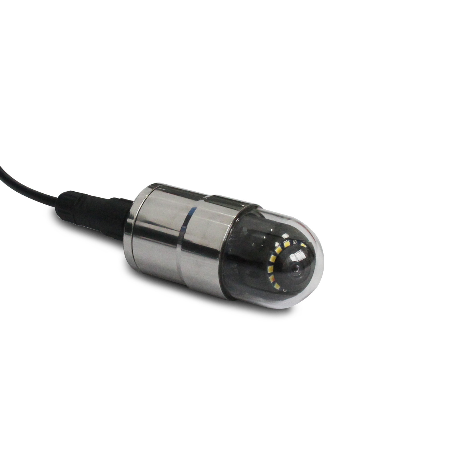
Today's borehole cameras take high definition pictures thanks to those fancy CCD sensors inside them. These devices often hit over 1080p resolution which means they can actually see tiny cracks and rock formations down there at the millimeter level. The LED lights built into these systems are pretty smart too. They let operators tweak brightness levels so shadows don't mess up visibility when working through murky water or weird shaped holes in the ground. Those tough armored cables connected to the cameras send information back instantly instead of waiting for someone to download stored data later on. This real time connection makes all the difference when geologists need to make quick calls while assessing sites for environmental studies or looking for minerals underground. Field workers simply change the light settings and angle of view as needed to tell apart different types of sediments from actual rock fractures, transforming basic site checks into active investigations right then and there.
Seamless Integration with Multi-Parameter Logging Systems for Correlative Analysis
Borehole cameras really boost what we can get from geophysical surveys because they tie together what we see visually with all those other measurements taken deep underground. When these cameras work alongside things like gamma probes, resistivity sensors, and acoustic televiewers, the pictures actually confirm whether those strange readings from other instruments make sense. This combination helps create much better 3D models of subsurface structures. For instance, when someone spots fractures through the camera lens, they can check those against actual water flow tests to figure out where fluids might be moving through rock formations. According to industry standards, putting multiple data types together cuts down on mistakes during interpretation by somewhere between 30 and 50 percent compared to just using one method alone. This matters most in areas where the groundwater situation is complicated and not straightforward.
Fracture and Discontinuity Characterization Using Borehole Camera Imagery
Quantitative Analysis of Fracture Orientation, Aperture, Spacing, and Connectivity
Borehole cameras provide the clarity required to measure important fracture characteristics that affect how rocks behave and how fluids move through them. When it comes to figuring out where fractures are pointing (their dip and direction), engineers typically use some basic trigonometry on the images they get. These measurements then go straight into creating those 3D models that help assess whether slopes will hold up or if tunnels might collapse. For aperture widths, technicians look at pixels against known scales. Research shows that when fractures are wider than 1 mm, permeability jumps dramatically - sometimes by hundreds or even thousands of times. Special software scans the space between fractures every half meter or so to spot areas where cracks cluster together densely. Meanwhile, connectivity maps highlight where different fractures cross paths because these intersections tend to be where most of the underground water actually flows. Studies back this up too: over 80% of what moves beneath the surface travels through just about 20% of all connected fractures. What this means in practice is that we're moving away from guesswork and toward real numbers that engineers can plug directly into their designs.
Lithological and Structural Interpretation from Optical Borehole Images
Identifying Lithology, Weathering Zones, Alteration Halos, and Bedding Features via Texture, Color, and Pattern Recognition
Optical borehole cameras, often called OTVs, give geologists detailed images that help them spot different rock types and structures based on things like texture, color differences, and how patterns look in space. When looking at these images, experts can tell apart sedimentary rocks from igneous or metamorphic ones just by checking grain sizes, how rough surfaces are, and overall fabric characteristics. Colors change quite a bit too, which tells stories about minerals changing over time. For instance, when there's iron oxide staining showing up, that usually means we're looking at weathered areas. Sharp color changes near cracks might indicate where hot fluids have altered the rock around fractures. Bedding planes tend to show up as those repeating horizontal lines in the pictures, whereas those angular breaks point toward faults or folded rock layers. According to research published back in 2018 by Wang and colleagues, having this kind of direct visual evidence cuts down on guesswork during interpretations by roughly 40% compared to relying solely on sensor data. Plus, modern pattern recognition software helps quantify things like how many fractures exist and what angle the bedding dips at, turning field observations into actual numbers for building better geological models.
Enhancing Geophysical and Environmental Survey Accuracy with Borehole Camera Ground Truth
Most geophysical and environmental surveys depend on indirect measurements like resistivity readings, seismic velocity data, or gamma responses. These methods can be confusing unless we actually see what's going on underground. That's where borehole cameras come in handy. They provide clear pictures from down below, letting us match up those numbers with what's really happening in the ground. Take contamination plumes for example. Camera images help spot how pollutants move through cracks and fractures in rock formations something regular sensors just can't detect. We also get to see fault lines and weathered rock layers that make our probability maps much more accurate and useful for real decisions. Research shows that using these cameras cuts down mistakes in interpretations by around 30% when dealing with complicated underground situations. When we combine what we see with all those geophysical numbers, we create a kind of learning cycle. Instead of guessing what might be there, we know exactly what exists beneath the surface, which saves money and leads to better solutions for cleaning up sites or finding resources.
FAQ
What are borehole cameras used for?
Borehole cameras are used for capturing high-resolution images of subsurface structures, helping in identifying fractures, discontinuities, and various geological features. They are vital for environmental studies, geophysical surveys, and mineral exploration.
How do borehole cameras enhance geophysical surveys?
Borehole cameras provide visual confirmation that complements data from other geophysical instruments like gamma probes and resistivity sensors. This integration improves accuracy and reduces errors in subsurface interpretation.
What is the significance of fracture characterization in geology?
Fracture characterization helps in understanding fluid flow and rock stability. It’s crucial for designing structures like tunnels and for predicting water movement through rock formations.
Table of Contents
- Borehole Camera Fundamentals: Enabling High-Resolution Subsurface Imaging
- Fracture and Discontinuity Characterization Using Borehole Camera Imagery
- Lithological and Structural Interpretation from Optical Borehole Images
- Enhancing Geophysical and Environmental Survey Accuracy with Borehole Camera Ground Truth
- FAQ